
Features UTM Measure
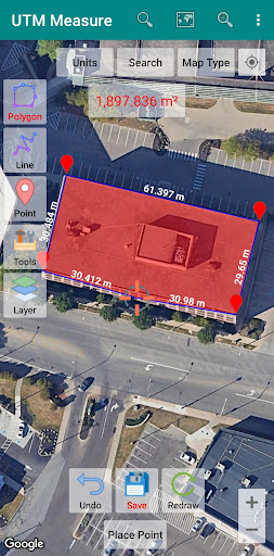
Measure area and distance, register points, lines and polygons from Satellite Imagery map data or GPS data, perform simple spatial analyzes such as overlays, buffering etc.Equipped with sophisticated spatial drawing & editing tools such as snap nearest, cutting / dividing polygons with lines, smoothing, reducing vertices using Douglas Peuckers algorithm, editing vertices of lines / polygons, combining 2 lines / joints, turning lines into polygons, polygons into lines etc.
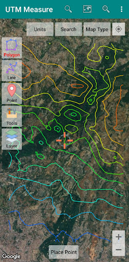
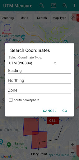
.Make a contour line (premium).Store unlimited amount of data in your local database including feature name information, photos, labels / notes, etc.Export your data to KML, DXF or CSV files.Working with Coordinate Reference Systems around the world from Minna Datum (Nigeria) to TM-3 (Indonesia), plot your polygons on a map based on coordinate data from various local CRS using EPSG Code.Supports WMS (Map Server).Any suggestions are welcome, please send via email to [email protected] or write a review.
thanks.
Camera Features
Advanced camera features with editing capabilities.
Fitness Tracking
Track your workouts and monitor your health metrics.
Learning Tools
Enhance your learning experience with interactive features.
See the UTM Measure in Action
Get the App Today
Available for Android 8.0 and above